Hiking in Joshua Tree: 100 miles for 100 years!
The National Park Service is 100 years old this year and that’s cause to celebrate! For us, it’s also a reason to be grateful. The NPS is an institution that reflects the foresight and hard work of Americans across generations to protect natural and cultural treasures for all of us to enjoy. We are taking full advantage and hope you’ll find a park to visit this year as well – you have 409 to choose from! We'd love to hear where you plan to go - use the comment box below, or drop us a line.
Now about those 100 miles… Joshua Tree National Park has issued a challenge to visitors: Hike a 100 miles in the park before the end of the 2016. (It has 200 miles of trails.) We are going to try to complete it before we leave at the end of February. Can we do it? UPDATE: YES, we can. We reached 100+miles in the park on Feb 20th!
We are using On Foot in Joshua Tree National Park as our main guide, supplemented by a topographic map, and a compass. It may seem like overkill, but it's not - as many of the hikes in Joshua Tree are not formal trails, but, as noted in our guidebook, "washes, canyons, valleys or ridges." And to our untrained eyes, everything looks the same! We are happy to report that we've found there are plenty of trail markers (sometimes signs using english words, but more often, rocks, logs, etc. signaling "do not go this way". ) It does demand that we pay as much attention to the trail as to the scenery...more than once we've each absent-mindedly walked right over a log that was meant to function as a stop sign. That's why we travel as a pair!
Total Miles to Date: 103.5

One of several easy nature trails that provide a nice introduction to the park.

Prior to becoming a national monument in 1936, it had been home to various tribal groups, rancher, miners and homesteaders. You can see some evidence of that on this trail.

This road can be an 18-mile tour itself - on foot or in a car - but it also links up to a variety of trails. Plus, it's one of the few places dogs are allowed!

Short does not mean easy - this was most remarkable as our first hike in deep sand. It's in the Black Rock Canyon area of the park.

A nice place for us to try out low-light photography and then follow-up with a hike.

We wheezed our way through this...thoroughly enjoying the middle miles which are like a roller-coaster. Good fun.
You can get a good look at rock climbers on this hike - and explore the Wonderland of rocks yourself. Easy out and back.

This run was half-in, half-out of the park. Most remarkable for the number of signs we missed and 2 miles up hill in the sand..it was more fun on the way back!

Great 360 views of the park are the reward for this hike. A lot of the path consists of stairs made of rock from the park. We appreciated the stairs for both their function and craftsmanship. We added 1.5 miles to the hike by starting and ending at Sheeps Pass campground.
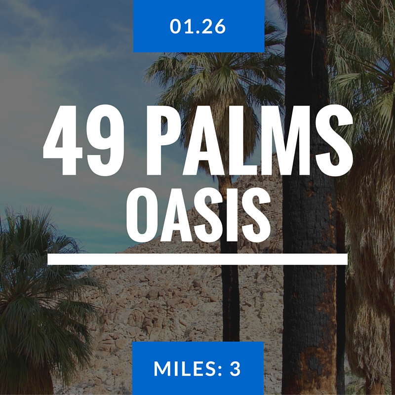
This trail had no Joshua Trees! It offered cactus and a palm oasis by a watering hole - which is also used by bighorn sheep. For that reason, the trail is for day-use only, so that the sheep can take water in peace (!) in the evenings.

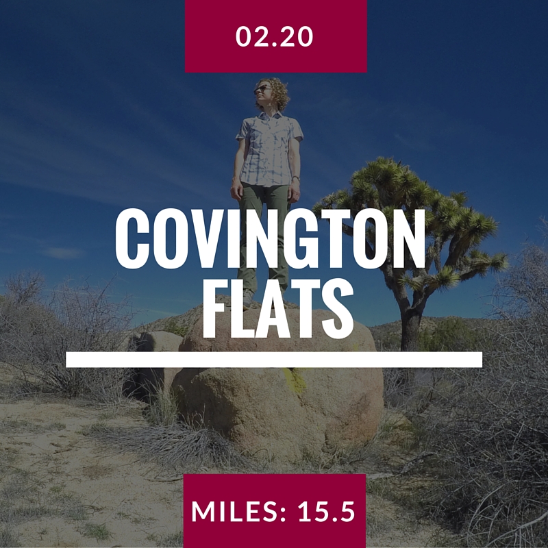
Our original aim was to take the California Hiking & Riding Trail to Upper Covington Flats - but a wrong turn at a fork took us on the Bigfoot trail. We did see sheep and coyote (we think) tracks - not a bad trade.
“Of all the paths you take in life, make sure a few of them are dirt. ”

Our favorite hike to date. Amazing views of the wind farm outside of Palm Springs and the San Bernardino National Forest. Some loose rock and sand near the top kept us on our toes!

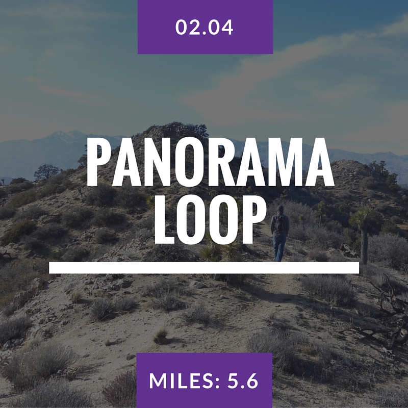
A week after our first time on this trail, we were more astute and successfully followed the trail for the full loop. We were rewarded with a diversity of landscapes and elevations. Worth the second try!

Physically easy hike, but a little hard to find the route. We did a bit of cross-country hiking from Quail Springs Trail (where we saw sheep on the way out and back) and found Samuelson's Rock. It features rock etchings made byJohn Samuelson, a 1920's homesteader.

This hike reminded us why it's a good idea to have a compass. In the middle of it, everything in all directions looks pretty much the same.

The second time around was no easier than the first. This time, we knew what to expect. Miles 1.0-1.75 not much fun. 1.75 - 3.0 = amazing! 3.0 - 3.65 awful. 3.65 to end, not bad.
This loop offers a winding path to great views, preceded by a walk through a small canyon of rock. A small detour provides views to the Salton Sea! We enjoyed it, but couldn't feel our hands by the time we were done. It was really windy!

This was probably the most crowded hike we've been on in the last month. It's popular because it's not too hard, and the payoff is to see a 100+ year old gold mine, up close.
A repeat of a hike we got lost on 2 weeks ago. Surprisingly straightforward when you know where you are going! Fairly uneventful hike - glad to hit our 100 mile goal!